Guidelines
The Guidelines set out the delivery standards for the essential data of archaeological knowledge useful for inclusion in the SITAR WebGIS. These standards supplement and do not replace the scientific documentation agreed with the Soprintendenza Speciale Archeologia, Belle Arti e Paesaggio di Roma staff member in charge of the area.
Delivery of Scientific Documentation
The procedures for the delivery of scientific documentation serve to provide uniform data structuring parameters, aimed at a timely extraction of the information systematized in the SITAR WebGIS.
The transcription of the essential identification data on research and scientific results thus becomes the initial act in the digitization and metadata tagging of the subsequent scientific processing.
The collaborator in charge of delivering the scientific, graphic and photographic documentation for each archaeological, geognostic, restoration or specialist study, must ensure that he/she submits the following digital summary documents to SITAR, complete with all the necessary metadata, to be prepared in the specified formats. At present, these data may be delivered concurrently with the remainder of the scientific documentation agreed with the staff member in charge of the study. For faster delivery, an upload tool will soon be available on this website allowing Professional Users to directly upload the files necessary for the implementation of the webGIS.
Documentation required
DA – Documentazione Amministrativa/Administrative documentation
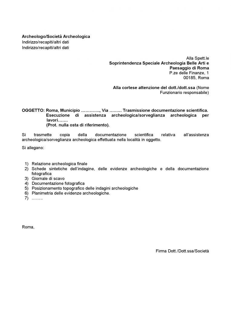
Delivery note on the documentation containing the list of documents presented.
Formato File: pdf/A
DS – Documentazione Scientifica/Scientific Documentation
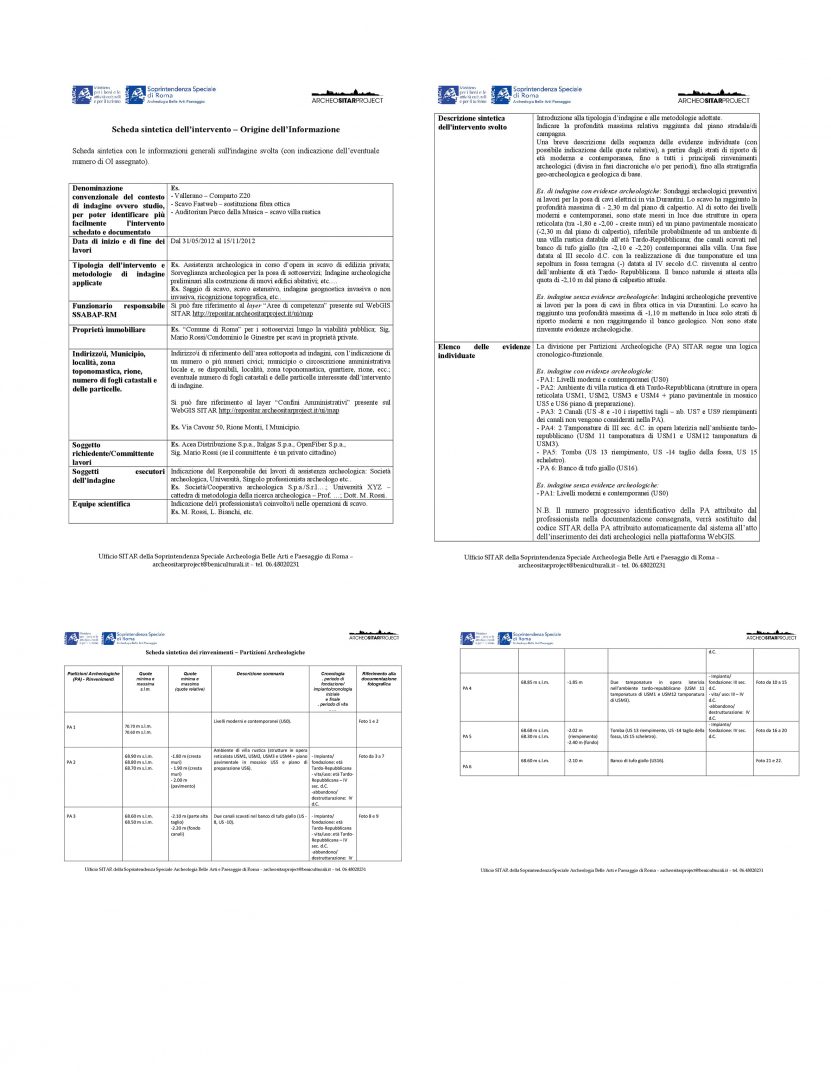
Records containing general information on the excavation and on each feature (PA/Archaeological Subdivision) identified.
Formato File: pdf/A
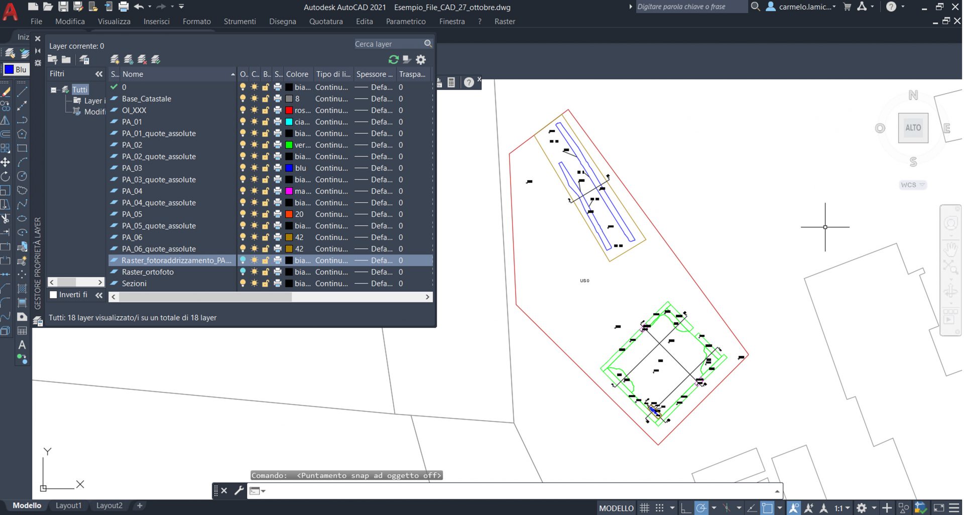
DGA – Documentazione Grafica/Graphic Documentation
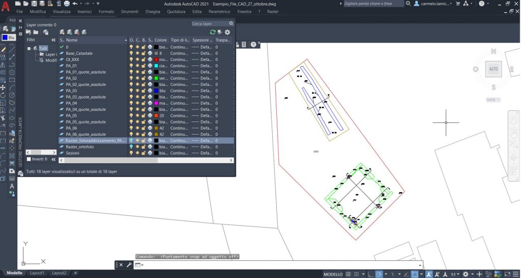
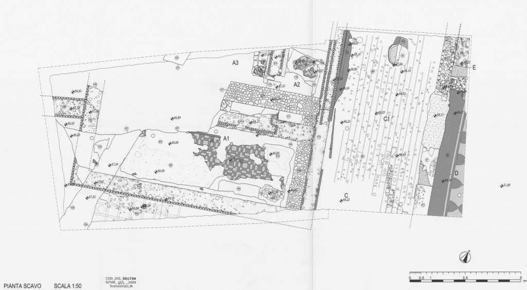
Topographical position, general and detailed plans, stratigraphic sections and elevations.
Formato File: dxf, dwg, shp, sdf, geodatabase
DI – Documentazione Fotografica/Photographic Documentation


General digital images of the study area and details of the features found.
Formato File: tiff, jpg

